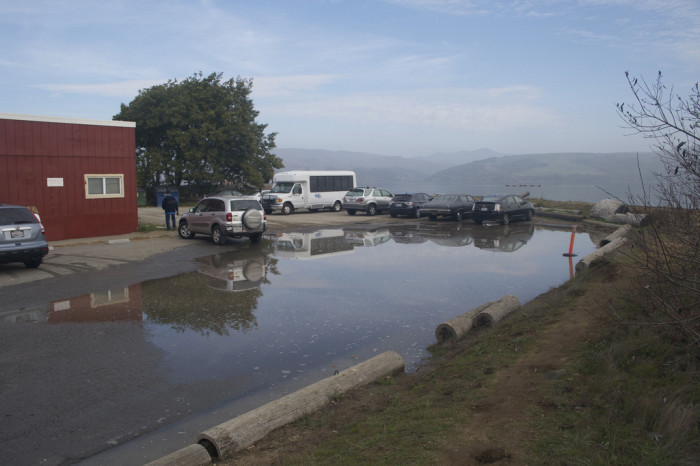
Inverness, CA – Photo credit: Abe Doherty
It’s that time of year again for king tides!
January 29th – 31st are the last days for California king tides during the 2013-2014 season.
The California King Tides Initiative is asking members of the public to take photos of the highest tides of the year to help document and visualize the potential impacts of sea level rise. All participants have to do is take photos of coastal areas during high tide and then upload them to the cakingtides flickr group page where they will serve as a living record of California’s shifting coast.
This is a cool project that combines citizen science with the realities of climate change. The idea is that the highest tides now will become the new normal as sea levels rise across the globe. And if that theory turns out to be accurate, California’s coast is in for some changes.
Definitely check out the cakingtides flickr group page and look through the photos, but beware it’s slightly addicting in a “watching a train wreck” sort of way. Flooding in some areas is really bad and some buildings look like they’re about to be gobbled up by the sea. You can’t stop the ocean, seems to be the main message over and over again.
If you really want to get into it, a variety of coastal organizations have identified “places of interest” to document changes from year to year because these areas are subject to flooding and erosion and high water levels can be gauged near familiar landmarks. But taking photos anywhere along the coast is helpful because the bottom line is, no part of the coast will be spared.
For those interested in getting involved, read more detailed information on the California King Tides Initiative website and take time to check when high tide is according to NOAA. Also, please be careful, avoid getting close to big waves!
Leave a Reply